|
Creek Near the Bottom of Blue Canyon
(Click images to view larger.) |
I reached the trailhead to Blue Canyon Lake near Sonora Pass at about 8:45 a.m., after making a little detour on the way up. I briefly lived in Sonora back in the late '80s, before the Hwy. 108 bypass went in, so I took a quick side-trip to check out the old route along Mono Way, hoping to grab a bite to eat at one of the fast-food joints I remembered.
Well, wow. The Wendy's wasn't there at all, and the Burger King was boarded up like the remnant of an old ghost town. I didn't linger to sort out my memories of what else had changed; the East Sonora Bypass opened in 2013, yet this was the first time I'd ever been curious enough to check out the old route. (I had also noted that the Jamestown Frosty was still there, although it looked, upon brief glance as I drove by, surprisingly decrepit, perhaps a casualty of the pandemic.) Farther up the highway, among mountainsides quilled with the charred remains of a fire-ravaged forest, the Dardanelle Resort was at least partially open again. Talk about resilience: the Donnell Fire (a campfire that turned into a 36,000-acre, $30 million, conflagration) wiped it out in 2018, and then a microscopic virus practically shut down the whole planet for a couple of years, but folks are bringing Dardanelle back to life.
I was also surprised by the changes I noticed as I stepped into the wilderness at the base of Blue Canyon Lake. Although spring has arrived, it's still a long way from the peak I experienced when I was last there in mid-August 2017. I encountered a fair amount of snow and ice on the lake back then, but none on this trip. The red-colored green algae (Chlamydomonas nivalis), so much in evidence on snow patches back then, had yet to become visible this season. As that blog post reminded me, I also passed through Yosemite back then, whereas this time I had to pass it up because reservations are required, even to just drive through, between 6 a.m. and 4 p.m.
I spent about three-and-a-half hours hiking up to Blue Canyon Lake and back, doing all my photography on the way up. I didn't plan it that way, but it's nice to take little photo breaks on the way up to the 10,056' elevation lake, especially if your lungs are accustomed to life at sea level. The slower travel, the newness of the landscape, the better light and lighter wind, all conspire to favor doing photography on the way up, leaving you to just take in the views and enjoy the relatively easy hike back down.
Although this rocky High Sierra trail in the Emigrant Wilderness is a long way from Mt. Tam in several respects, the distance suddenly closed when I caught the familiar song of mountain bluebirds, which sound much like our western bluebirds here on the coast. I never actually saw the birds, and about the only animal I did see along the trail was grasshoppers. I had to wonder how in the world those little critters survive the winter, and according to Bug Guide, they "apparently overwinter as eggs." I did see several marmots sunning themselves on boulders near the trailhead parking area, but not so much as a chipmunk along the trail. I once photographed a mule deer near a fiddleneck meadow high up the trail, but that was in September 1992, and I haven't encountered a scene like that in the thirty years since.
Another solo hiker reached the lake just as I was heading back down, and I ran into a group of three adults and two small children resting on the way up. They had not reached the slightly tricky creek-crossing and rock-scrambles yet, and one of the adults, a very jovial fellow, was carrying a long fishing rod despite the lake at the top of the trail being fishless. High Sierra lakes do not naturally have fish, so those that do have been stocked by the California Department of Fish & Wildlife, and Blue Canyon Lake does not get stocked.
 |
Flush of Trailside Lupines
|
 |
| Scarlet Gilia and Mule Ears |
 |
| Pale Columbine Flowers |
 |
| Waterfalls Below Blue Canyon Lake |
 |
Wallflowers in the Rubble
(with view of Sonora Peak) |
 |
| Weathered Pine Wood |
 |
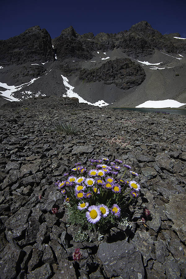
| Alpine Fleabane in the Lake Basin |
 |
| Sierra Beardtongue Licks the Rocks to Find a Toehold |
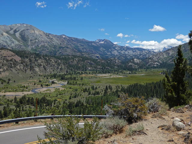 |
Leavitt Meadow
(on the east side of Sonora Pass) |
 |
| Mono Lake Overlook on I-395 |
Hiking up Blue Canyon was a great way to break up the long drive to my farthest destination of Onion Valley, in the Eastern Sierra above the town of Independence. The only other time I've been there was when my wife and I spent a night in mid-July of 2010. We were the only campers there, and my wife found it kind of bleak. I figured on this trip that I could easily snag a campsite and hike up to Kearsarge Pass the next day.
Nope! Not only were the wildflowers different on the way up the mountain (not as prodigious, that is), but I didn't even recognize the place when I finally arrived. There were cars galore parked near the trailhead, and the campground was fully reserved (and cost $29/night!). It was about 5 p.m., so I decided to just hike up to the first lake, about one-and-a-half miles up the well-graded trail. It was much easier to keep a steady pace up those switchbacks fit for horse travel than it was to hike the scree of Blue Canyon. The forest and surrounding mountains were beautiful, especially University Peak (13,589' elev.) which looks a little bit like the east face of Mt. Whitney.
I reached Little Pothole Lake as the sun was about to dip behind the western peaks, so I took a few pictures and gave a little blood (to swarming mosquitoes, that is), then headed back down to my car. A few clouds made for a nice sunset over the Eastern Sierra escarpment, and I pulled off the highway to snap a few frames on my way to visit the Ancient Bristlecone Pine Forest.
 |
| Little Pothole Lake & Sierra Peaks |
 |
| Kearsarge Pass Trail |
 |
| View from Onion Valley |
 |
| Sunset Silhouette |
It was fully dark when I reached Grandview Campground. I drove to a favorite and familiar campsite, but it was already taken, so I had to poke around in the dark to find something suitable. Thankfully this campground is still wild, still first-come, first-served, and there is no camp host like at Onion Valley. After making a couple of wrong guesses at campsites that were, in fact, occupied, I finally found a little cove of my own and set up my tent by the blazing light of my headlamp (whose batteries I had recharged before leaving home).
Although the moon was waxing to about half-full, the stars were great, and the arc of the Milky Way traversed the night sky. It was directly above me the first time I woke up and looked, then quite a bit lower the next time. I didn't look at my watch either time, and I quickly dismissed any thought of trying to photograph it. I believe you can use Photographer's Ephemeris to plan Milky Way shots, but not on the free version I have. Once you have your plan, all you have to do is roust yourself out of your sleeping bag at the appointed wee hour.
I was the first to arrive at the Visitors Center parking lot to begin the four-mile loop around the Methuselah Trail. I decided to hike it earth-wise, which is counter to the posted signs. I didn't have a brochure for the sixteen or so trail markers anyway, and the part of the forest I was most interested in photographing is at the end of the counter-clockwise route. I didn't note the time I began the hike, but it was probably around 7:15 a.m., and by about 8:30 the light had gotten too harsh for my taste. The Visitors Center, which opens at 10, was still closed by the time I'd completed the loop. I hadn't noticed the sign when I arrived, but they've introduced a new $3 day-use fee.
 |
| Bristlecone Pines on the Methuselah Trail |
 |
| Bristlecone Pine Forest |
 |
| Small Living Branch on Ancient Bristlecone Pine |
 |
| Bristlecone Pine with Column of Dolomite |
 |
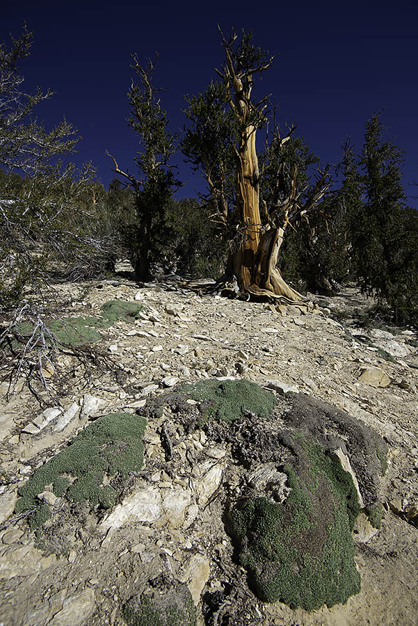
Earth Hugging Plants
(It looks like moss, but it produces small yellow daisy-like flowers.) |
 |
| Cliffhanger |
 |
| Bristlecone Pines Trying to Look Scary |
 |
| Bristlecone Dancer |
 |
Purple Sage
(without riders) |
About half-way through the Methuselah Trail, I started to feel a little like old Methuselah myself. I'd been proud of my high-elevation hiking stamina so far, but rather suddenly my legs began to feel very tired. I needed a rest day, so I descended back to the town of Big Pine and went up the other side, up Glacier Lodge Road (which starts out as Crocker Avenue off Main Street). I'd never been up there before, and it was gorgeous, but again my lack of planning wasn't panning out, as the area's campgrounds appeared to be full. There was only one car parked at the no-shade trailhead which was situated below some daunting mountains. I'd hoped to hike up toward First Lake at just under 10,000 feet, but I didn't think my legs were up to the job, so I'll have to check that out on my next visit. Maybe go up with my wife and rent a cabin at the lodge ($185/night) to do it in style and comfort.
 |
Sonora Pass Vista Point
(looking northwest) |
 |
Same Sonora Pass Vista Point
(looking southeast) |
 |
Fire Scarred Landscape Along Highway 108
(from bridge over the Middle Fork Stanislaus River east of Dardanelle)
|
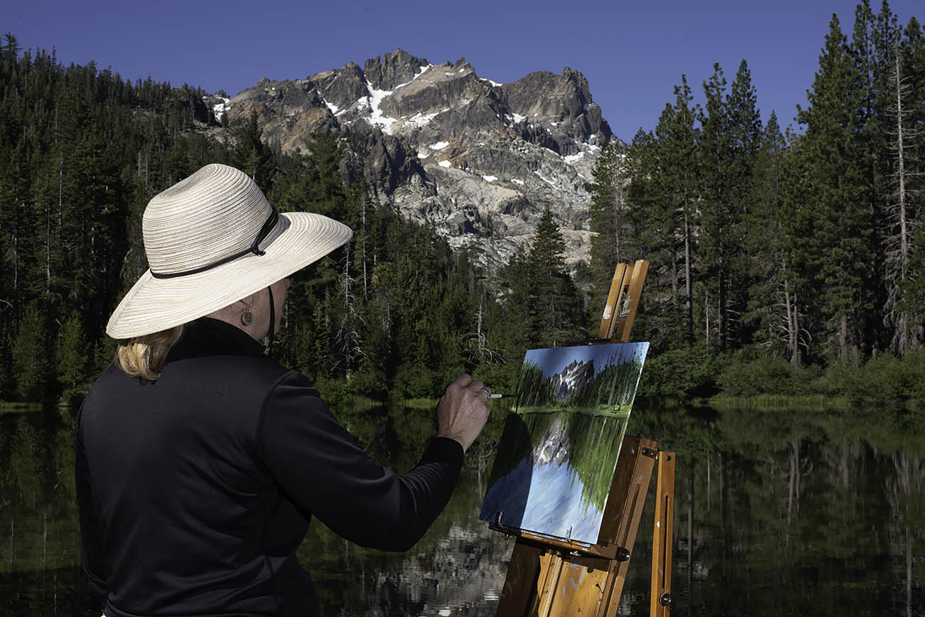
It's too bad it's all such a long drive away. I'd love to go back soon, and I know Pam would dig it and want to do some painting (she's away at an art retreat now). Gas was expensive of course, but not by San Francisco standards. Bishop had the cheapest gas, and was the only place you could score a gallon for less than six bucks. Lee Vining and Bridgeport had the highest prices (as always), and the only prices higher than San Francisco's. Both towns' gas stations clocked in well north of seven bucks. I cringed as I watched a huge RV start to pull into the gas station in Lee Vining, only to feel relief when he realized his mistake and continued to the RV park entrance next door. I was able to fill up in Bishop and get all the way home (via Sonora Pass) with about a third of a tank remaining in my Mazda 3. The only bummer is my bum, which did not like being in that seat for so long (anything more than about four hours gets tough). And speaking of cars, in the old days if a vehicle blew past me on the freeway at 90-100 mph it was the CHP; nowadays it's just about anybody (I was traversing the valley at around 8-10 p.m.).
* * *