|
| Big Pothole Lake |
Yosemite National Park stopped requiring reservations at the end of September, so I decided to use Tioga Pass to reach the Eastern Sierra. I looked forward to getting my lifetime National Parks Senior Pass, even though the price went from $10 to $80 just five years ago. As it happened, I passed through so early that I entered and exited the park before the entrance stations were staffed, so I never got my pass. Tuolumne Meadows was frosty, by the way, and potentially worthy of a photo stop. I pulled over and got out of the car in my shorts, t-shirt, and flip-flops, and decided to just remember how nice it looked for a future stop. My car's thermometer indicated it was 30 degrees outside.
I couldn't just put on my hiking shoes and a jacket because I'd actually forgotten to pack my hiking shoes! When I realized my mistake I very briefly considered whether I could do the Kearsarge Pass hike in my flip-flops, which are nice flip-flops, but not that nice. I figured I could buy a pair of shoes in Bishop, and sure enough I spotted a Big 5 as soon as I got there. It was only 9:30, though, and they weren't open yet, so I went to a taqueria a few doors down and got a breakfast burrito that was so massive I didn't need to eat again until that evening. When the Big 5 opened at 10, I picked up a decent pair of Columbia hiking boots for about $80. As I continued south through Bishop on my way to Independence, I noticed that the old Galen Rowell photo gallery has become the Mammoth Gear Exchange, which I'll remember for future excursions if I need to replace forgotten gear.
The online reservation system for the Onion Valley Campground at the trailhead for Kearsarge Pass indicated that sites were unavailable to reserve on Mondays and Tuesdays this month, and were first-come, first-served only. But when I got there the guy who collects the fees said there's no such thing, but luckily there was still an unreserved site. Unlike my visit back in July, I was at least able to get a campsite for that night ($29/night and you have to bring your own drinking water), and that night only. Having gotten on the road at around 2 a.m., I'd hoped to relax in camp the rest of the day and get used to the altitude, but I wasn't sure I could complete the hike the next day before check-out time. So I set up my tent, grabbed my camera and tripod, and set out on the trail at about 12:30.
The hike starts at 9,200 feet, and I reached the terminus of my last visit, Little Pothole Lake, after an hour or so, blissfully unaware of how much trail was still between me and the 11,823-foot pass. I encountered several hikers who were descending as I was going up, and I overtook one pair of backpackers who were also going up. When I finally reached the pass I met a young lady who was waiting for the backpackers I had passed. She had been hiking the John Muir Trail for 17 days and was getting re-supplied by those backpackers -- her parents! I was in awe, and I told them when I saw them on my way down that they are the Best Parents Ever, which they downplayed by saying, between breaths sucking for thin High Sierra air, that they love hiking.
One of the hikers I met on the way up had asked how far I was going, and I said I was going to hike as far as I could get by about 4 o'clock, figuring that would give me plenty of time to make the return trip before it got dark and cold. What surprised me was the trip back down the trail took about as long as the hike up. I reached the pass at around 3:30 and was back at my tent at 6:30. Not only did the 9.6-mile round-trip confirm, at least to my mind, the impossibility of hiking that trail in flip-flops, but it also made me feel like I'd come very close to the physical limit of what my legs are capable of delivering in a single day. When I finally got all the way down, my tent and sleeping bag never looked so good.
The next day I drove home by way of a "fall color" route that took in Glacier Lodge, which turned out to be a disappointment, then Rock Creek (excellent), and McGee Creek (so-so, and I didn't have the energy to hike up the canyon where it might have been more interesting). Pretty much the whole Eastern Sierra from Rock Creek north to Dunderberg Meadow had good fall-color displays. I drove up Sonora Pass to spend the night, but ended up dropping down to the Clarks Fork River where it was warmer, and where I slept under the few stars that were able to compete with the waxing gibbous moon.
 |
| I lost track of which lake was which, but I think this is Gilbert Lake, which is just above Little Pothole Lake. |
 |
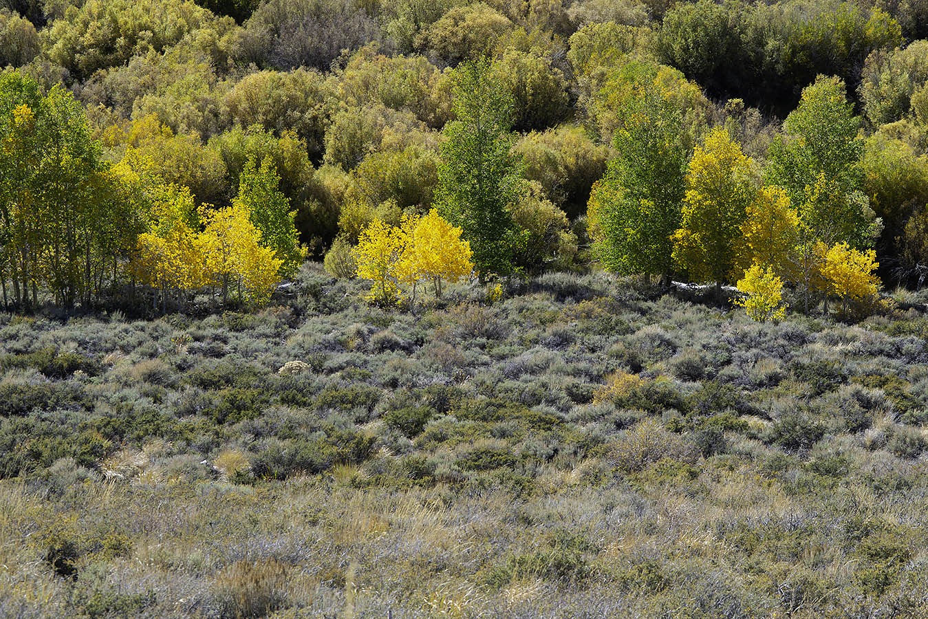
| All the "fall color" along the Kearsarge Pass Trail was the yellow in the willows. |
 |
| This little golden mantled ground squirrel showed no fear, and I wondered if folks had been feeding him. But he dug into the earth, creating the hole behind him, and ate whatever he found (which doesn't look like anything but sand, so maybe it's a mineral or myco thing). |
 |
| About the worst light ever in this view into King's Canyon from Kearsarge Pass, but I lugged my gear all the way up there, so you better believe I took a picture. |
 |
| I wonder if the last couple of thin, toothy spires on the left used to have more company. You gotta love the geology out here. |
 |
| Moon and Moonscape |
 |
| Afternoon shadows encroached on the lakes and vistas as I headed back down the trail. |
 |
| Lakeside View |
 |
| This was one of the last frames I dug my camera out for, as fatigue was gnawing away at my desire to dig out my camera and set up the tripod. |
 |
| Leaving Onion Valley, with Fall Color in the Rabbitbrush |
 |
| The red-tailed hawk, star of the valley, didn't fly away when I stopped the car, but took off when I broke out the paparazzi gear. |
 |
| Aspen Leaves on Dark Granite Boulder |
 |
| They were resurfacing a long stretch of Rock Creek Road, and we had to follow a pilot car past all kinds of enticing fall color action, but fortunately there was still plenty left after they let us go. |
 |
| Green Leaves Keeping Each Other Company |
 |
| Aspen Trees Ablaze |
 |
| Rock Creek Lake |
 |
| View Along McGee Creek Road |
 |
| Crowley Lake from McGee Creek Road |
 |
| This is the bottom edge of Dunderberg Meadow. |
 |
| There's still lots of color to come at Dunderberg Meadow, judging by all the aspens that are still very green. |
 |
| Panorama Along Sonora Pass |
 |
| From the same position as the panorama, but looking the other way, I was drawn by the trees finding a place to grow on the face of the mountains. |
 |
| Layers of Rock and Trees |
 |
| I stopped somewhere along the road past Kennedy Meadows at a spot I've never photographed before, where the river drops through a beautifully carved canyon. |
 |
| Water Sculpted Sierra Granite |
 |
| I wish I could have had someone posing at the bottom to give the scene some scale, but there's really no way to get down there anyway. Just looking down from the edge made my stomach queasy. |
 |
| But queasy stomach or not, it was just too enticing to stay away. This place would probably be too nerve-wracking for parents with small, rambunctious children. |
 |
| That big tree snag at the top of the frame is driftwood. You can imaging what this chute looks like when it's full of spring run-off. I was amazed to see salmon trying to leap up the waterfalls. How the fish even got this far is mind-blowing. |
 |
| This mullein also could have used a person for scale. It's taller than my own six feet in height. I thought about getting in the frame, but it would have marred the beauty of the plant. |
 |
| $8 Gas: Sign of the times in Lee Vining. |
 |
| Goofy Guy at Kearsarge Pass |
* * *