 |
| Dreaming of a Wet Winter |
 |
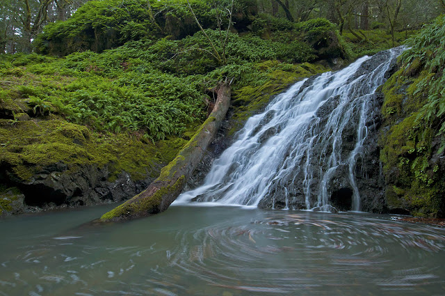
| There's currently very little water in Cataract Canyon. Too bad (photographically speaking) that a dead tanoak flopped down into the pool. |
It felt a little strange to be driving up to Mt. Tam to go for a hike on a weekday. I don't really like to use the car to do something I can sorta do just by walking out my door. But the paved sidewalks of San Francisco are not the rocky trails of Tamalpais, and I had a particular hike in mind that I haven't done in a long time, a loop from Rock Spring to Alpine Lake, about 8.2 miles according to my Tom Harrison Map. The hike drops down the Cataract Trail past Laurel Dell to the Helen Markt Trail and reaches its lowest elevation at Alpine Lake. Then you start back up via the Kent Trail, to High Marsh Trail, to Cross Country Boys Trail, and the Azalea Meadows Trail to Rifle Camp, amble on past Potrero Meadow and pick up the fire road to Barth's Retreat, then finally head up and over the Benstein Trail to get back to Rock Spring.
There's kind of a subtle effect you feel on this hike, which descends, often very steeply, down the rocky gully of Cataract Creek. You're in the woods the whole time, and are only able to see the sky through the tree canopy directly above you. The long descent through the filtered light of the forest eventually brings you to a large pool of water that is Alpine Lake, and the vista opens up. You leave only reluctantly, and the reason why doesn't sink in for a minute. You just left a beautiful and easy place of rest, a place of wide-open vistas and abundant water. You soon find yourself again within the depths of the forest, and the hike back up the mountain is fairly strenuous, especially in the steep and rocky sections. You finally reach the fire road at Rifle Camp and come out into the open once again at Potrero Meadows. You emerge from the woods feeling like you just had a kind of miniature mythic adventure, a traveling downward, or inward, followed by a rising, or returning.
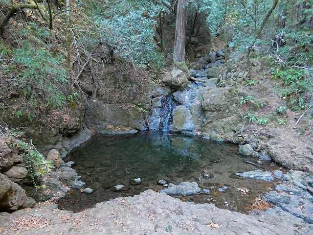
Early in the hike I passed a couple of guys on the Cataract Trail and didn't see anyone else until I was heading up the Kent Trail, where I was surprised to see a young lady just a ways up the trail taking a picture of something with her phone. We greeted each other at a distance, and the young lady resumed hiking up the narrow trail. I slowed my pace so I wouldn't catch up to her since I could only imagine how she felt about suddenly having some guy following her up the trail in the middle of nowhere. Fortunately I soon reached a place I wanted to stop, and she was able to hike far ahead of me. The place I stopped is called Foul Pool.
Which is a total misnomer if you ask me. You wouldn't want to dip your hands in the pool and drink (when there's water in it, that is), but I see it as more "interesting" than "foul." It was full of smartweed and cattails (some of which had been browsed by deer), but the ground was dry enough to walk on. Ditto for Hidden Lake a little farther up (with a slight detour along the Stocking Trail).
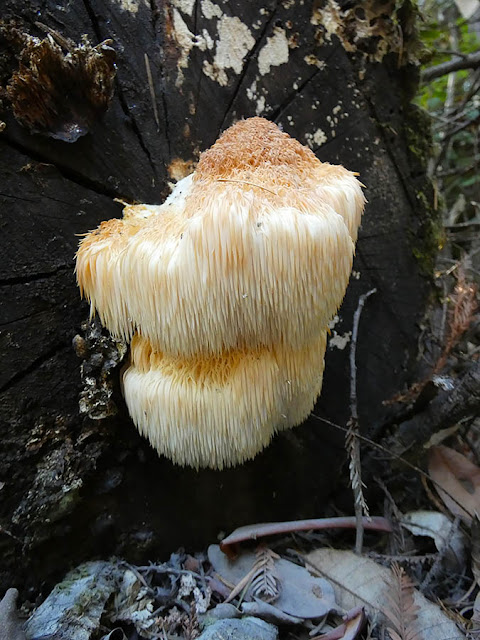
In between the two swamps I found a lion's mane fungus that seemed ripe for the picking. Unfortunately, I hadn't expected such bounty and didn't have a pocket knife or wax paper bags to collect it. I soon found another fruiting of this beautiful toothed fungus, and then a third and fourth fruiting close together on the same log. According to California Mushrooms, this species grows on living hardwood trees. However, the three I found were growing on downed trees, two of which were tanoaks, but the first of which was on what I'm pretty sure was a fallen Douglas fir.
I'm always impressed yet slightly pissed off when I see mountain bike tracks on these trails, which are not legal bike routes. The trails aren't wide enough for two people to walk abreast much less to have a mountain bike fly by. It's too bad there isn't a way to close certain trails to hikers for a day every now and then so the mountain bikers can ride without causing conflict and potential injury to hikers.
The hike that I usually do with my wife is about six miles and takes me two hours. This hike only adds another two miles, but it took a little more than four hours because of the steep terrain.
 |
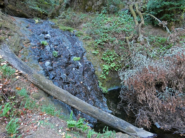
| More dreaming, and just one more comparison.... |
 |
| Yep, same place. |
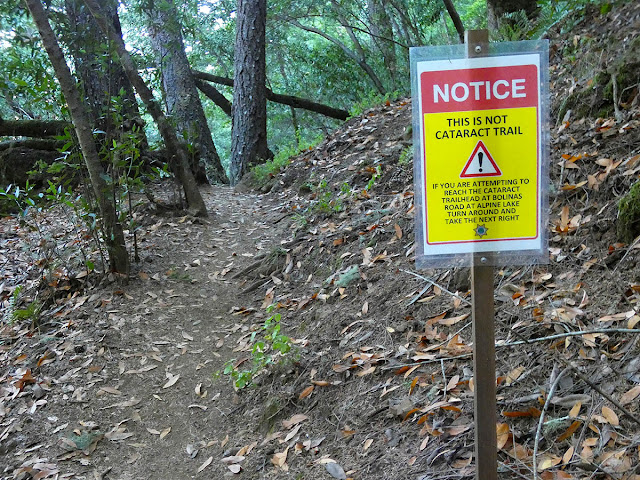 |
| This is a new sign warning people who accidentally veer off the Cataract Trail onto the Helen Markt Trail. I can see how you might be chatting with friends or being otherwise distracted and not notice the fork. I can't help wondering how far people have gotten before they realized their mistake, but in any event someone must have gotten the attention of the Sheriff's Department (which runs local search and rescue operations). |
 |
| Such a beautiful sound: Swede George Creek was the only creek I encountered that actually had running water in it. |
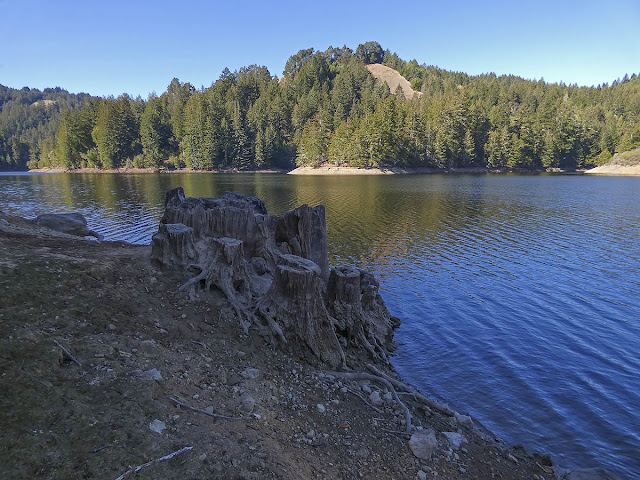 |
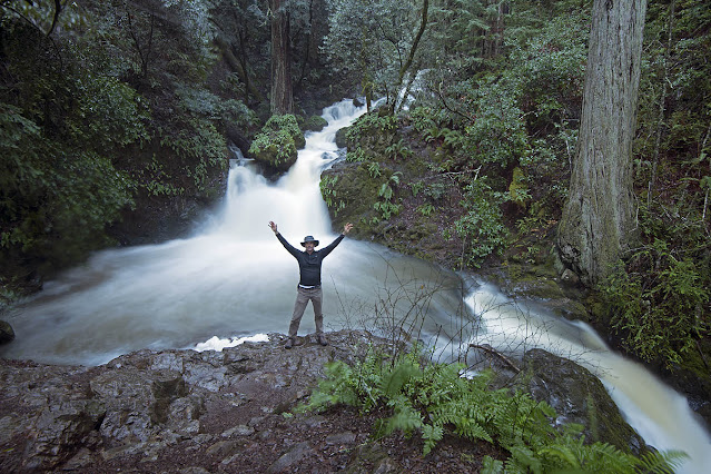
| Alpine Lake |
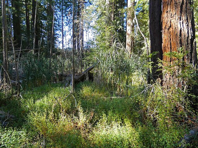 |
| Foul Pool |
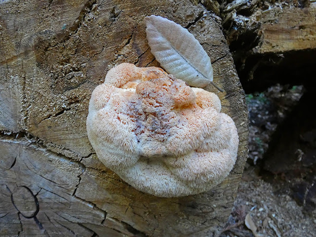 |
| Lion's Mane Fungus (with tanoak leaf for scale) |
 |
| Another lion's mane showing more growth in its spines. |
* * *


