Friday, October 28, 2022

Rock Spring to Alpine Lake


Dreaming of a Wet Winter


There's currently very little water in Cataract Canyon. Too bad (photographically speaking) that a dead tanoak flopped down into the pool.


It felt a little strange to be driving up to Mt. Tam to go for a hike on a weekday. I don't really like to use the car to do something I can sorta do just by walking out my door. But the paved sidewalks of San Francisco are not the rocky trails of Tamalpais, and I had a particular hike in mind that I haven't done in a long time, a loop from Rock Spring to Alpine Lake, about 8.2 miles according to my Tom Harrison Map. The hike drops down the Cataract Trail past Laurel Dell to the Helen Markt Trail and reaches its lowest elevation at Alpine Lake. Then you start back up via the Kent Trail, to High Marsh Trail, to Cross Country Boys Trail, and the Azalea Meadows Trail to Rifle Camp, amble on past Potrero Meadow and pick up the fire road to Barth's Retreat, then finally head up and over the Benstein Trail to get back to Rock Spring.

There's kind of a subtle effect you feel on this hike, which descends, often very steeply, down the rocky gully of Cataract Creek. You're in the woods the whole time, and are only able to see the sky through the tree canopy directly above you. The long descent through the filtered light of the forest eventually brings you to a large pool of water that is Alpine Lake, and the vista opens up. You leave only reluctantly, and the reason why doesn't sink in for a minute. You just left a beautiful and easy place of rest, a place of wide-open vistas and abundant water. You soon find yourself again within the depths of the forest, and the hike back up the mountain is fairly strenuous, especially in the steep and rocky sections. You finally reach the fire road at Rifle Camp and come out into the open once again at Potrero Meadows. You emerge from the woods feeling like you just had a kind of miniature mythic adventure, a traveling downward, or inward, followed by a rising, or returning.

Early in the hike I passed a couple of guys on the Cataract Trail and didn't see anyone else until I was heading up the Kent Trail, where I was surprised to see a young lady just a ways up the trail taking a picture of something with her phone. We greeted each other at a distance, and the young lady resumed hiking up the narrow trail. I  slowed my pace so I wouldn't catch up to her since I could only imagine how she felt about suddenly having some guy following her up the trail in the middle of nowhere. Fortunately I soon reached a place I wanted to stop, and she was able to hike far ahead of me. The place I stopped is called Foul Pool. 

Which is a total misnomer if you ask me. You wouldn't want to dip your hands in the pool and drink (when there's water in it, that is), but I see it as more "interesting" than "foul." It was full of smartweed and cattails (some of which had been browsed by deer), but the ground was dry enough to walk on. Ditto for Hidden Lake a little farther up (with a slight detour along the Stocking Trail). 

In between the two swamps I found a lion's mane fungus that seemed ripe for the picking. Unfortunately, I hadn't expected such bounty and didn't have a pocket knife or wax paper bags to collect it. I soon found another fruiting of this beautiful toothed fungus, and then a third and fourth fruiting close together on the same log. According to California Mushrooms, this species grows on living hardwood trees. However, the three I found were growing on downed trees, two of which were tanoaks, but the first of which was on what I'm pretty sure was a fallen Douglas fir.

I'm always impressed yet slightly pissed off when I see mountain bike tracks on these trails, which are not legal bike routes. The trails aren't wide enough for two people to walk abreast much less to have a mountain bike fly by. It's too bad there isn't a way to close certain trails to hikers for a day every now and then so the mountain bikers can ride without causing conflict and potential injury to hikers.

The hike that I usually do with my wife is about six miles and takes me two hours. This hike only adds another two miles, but it took a little more than four hours because of the steep terrain.


More dreaming, and just one more comparison.... 

Yep, same place.


This is a new sign warning people who accidentally veer off the Cataract Trail onto the Helen Markt Trail. I can see how you might be chatting with friends or being otherwise distracted and not notice the fork. I can't help wondering how far people have gotten before they realized their mistake, but in any event someone must have gotten the attention of the Sheriff's Department (which runs local search and rescue operations).


Such a beautiful sound: Swede George Creek was the only creek I encountered that actually had running water in it.


Alpine Lake


Foul Pool


Lion's Mane Fungus (with tanoak leaf for scale)


Another lion's mane showing more growth in its spines.

* * *

Monday, October 24, 2022

New Moon Blues


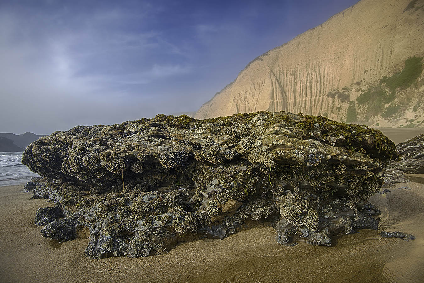
Sand Tufa at Mono Lake


A couple of years ago I happened to be out on my morning walk when I saw the most beautiful waning crescent moon poised perfectly between Twin Peaks. It was the day before the October new moon. When I got home I grabbed my camera and took a picture, even though the moon was no longer in the perfect place, to remind me to try again the following year. When I went out the following year, the moon still didn't line up right. It was two days before the new moon, so I thought I would have another chance the following day, but I was shut down by fog.

So I've been waiting all year for yet another chance, and this morning was it. I woke up and looked out the window. All clear except for a few wispy clouds which, if anything, might even enhance the scene. I got dressed and hauled my gear up the road and set up my tripod, and then I waited. And I waited some more, watching with mounting concern as the morning was becoming too bright to see a little ole crescent moon. Somewhat perplexed, I gave up and went home.  

I wondered what went wrong. I figured the key factor was simply to be in the same place, just before sunrise, a day or two before the October new moon. But the heavens don't run like clockwork in that way.

On October 15, 2020, when I was first wowed by the crescent moon, it rose 1 hour and 32 minutes before sunrise.

On October 4, 2021, the moon rose 2 hours and 9 minutes before sunrise.

And on October 24, 2022, the moon rose just 54 minutes before sunrise.

So for the crescent moon to be in the right place at the right time, I thought maybe I don't need it to be October at all. Maybe all I need is a difference between moonrise and sunrise that's close to 1.5 hours. As it happens, the difference on November 22 will be about 1.5 hours. Even better, the November crescent moon will be about three percent full, the same as the "wow" moon of two years ago.

I got myself all excited, thinking all I need now is a clear morning next month. But nope, wrong again! I'd forgotten that in September the moon rises too far north, and in November it rises too far south. The sad fact is, I probably do need the moonrise to be in October, and with about 1.5 hours between moonrise and sunrise, so that the moon's arc puts it between Twin Peaks at just the right time. 

Drat. 

If that's correct, it looks like my next best chance, with moonrise at 0539 and sunrise at 0720 (1 hour and 41 minutes difference), will be six years from now, on October 16, 2028.... 

(Since this post is about a picture I could not shoot, the two Mono Lake shots are from a long time ago, something at least tangentially attached to the idea of the new moon....)


Navy Beach Sand Tufa

* * *

Friday, October 21, 2022

Mountain Music


Mountain Pool


There's a nondescript pool of water along the Mill Valley-Sausalito Pathway. It's not attractive in any way, not even to the birds, but I always figured it would catch a reflection of Mt. Tam. It's one of those scenes you know is always going to be there, so you tell yourself, "Maybe next time." Well, once again yesterday I was pedaling at cruising speed, closing in on my turn-off to Coyote Creek, and thinking "maybe next time," when I hit the brakes and pulled off the path to get it done. Procrastinating until the return trip doesn't work because the wind always comes up and ruffles the mirrored surface.

Having shot one reflection of the mountain, I was in the mood to collect another when I saw three black-necked stilts resting on the far edge of Coyote Creek, which was pretty close to its 4.9-foot high tide mark for the day.

It was another beautiful day for a ride on the mountain, sunny and warm, almost spring-like. Even a patch of western azalea along Panoramic Highway thought so. It's interesting to see these flowers blooming in October since they usually bloom around May or June on Mt. Tam. Farther up the mountain, and more seasonally correct, the scarlet blossoms of California fuchsia are still going strong, and in the woods I found a large dyer's polypore.

The camera trap pool looked pitifully small again, and to make it even worse its surface was covered with a powdery substance called "powder down" that indicated band-tailed pigeons had been bathing in the pool. A quick review of the first few images captured on the camera revealed pigeons and also numerous virtually empty frames that likely had been tripped by dragonflies whizzing by. It was all just a little too disappointing, so I decided to move the cam to a new location. I also brought the new GardePro cam and set it out as well. 

I was scouting new locations when I surprised a gray squirrel that, instead of immediately bounding away, actually moved a little closer to see what manner of intruder was infringing on his turf. I almost never get a chance to photograph squirrels on Mt. Tam because they tend to keep their distance from humans. But maybe they are slightly more territorial now that it's acorn-collecting season.

A couple of tiny downy feathers lying on top of the forest duff caught my attention, and I'm going to guess they came from a band-tailed pigeon. Some red-breasted nuthatches were calling to each other as they searched for insects in the trees. They were too quick to catch with the FZ80, so I settled for a dark-eyed junco. The junco initially fluttered up from the ground to the far side of the tree trunk, but I had a feeling he would eventually make his way up to the mossy look-out and reveal himself.

There were a few trucks parked at Rock Spring, getting ready for the Sound Summit on Saturday. The music festival was called the Mt. Tam Jam when it started back in June 2013 (but had to be changed after some legal scrimmaging). I had just deleted all my blog posts going back to 2007 in order to start a one-year project exploring the mountain, thinking I would quit the blog after that year. We went to the Tam Jam in that first month of the "new" blog. The festival was the first on Mt. Tam since 1967, when bands like The Doors and the Steve Miller Band played. Another band at that festival was called Moby Grape, which I mention in part because I love the name, but also because its lead guitar player has a daughter who's having a baby with one of my nephews next month. Yay! 


Black-Necked Stilts on Coyote Creek


October Azaleas On Panoramic Highway


Dyer's Polypore


Video Screen-Captures of Band-Tailed Pigeons


Feisty Gray Squirrel


Downy Feathers


Junco on the Look-out


The lower branches of dead these trees near Rock Spring were preened for wildfire protection not too long ago, but I'm guessing the yellow ribbons tied around the old fir trees have marked them for removal.


Camera Trap Clips

* * *

Tuesday, October 18, 2022

Surf's Up!


Most days my bike ride takes me down to the beach, and I noticed yesterday that a little swell had come in, along with a slightly offshore breeze. When I got home I checked the swell forecast and it looked like it was going to improve today (and possibly get even bigger throughout the week), so I planned to bring my FZ80 down to the beach (at Noriega Street) on my morning walk today. I wasn't sure the little camera would be able to capture action shots, but it did okay in the somewhat diffuse morning light. You only get one chance to trip the shutter, though, because by the time the image writes to the SD card and the viewfinder refreshes, the ride is usually over.

After I walked back home I got on my bike to shoot some other locations, hoping to find a surfer or two who could really rip. I thought I'd start on the bluffs near the Giant Camera, but just like yesterday, Kelly's Cove was not catching the swell, so my first stop was along the Esplanade. From there I rode south along the Upper Great Highway (which is open to cars again), making stops at Rivera and Sloat. In the end, there was no "best" location with the most ripping surfers on the best waves, so just about anywhere is a good spot to check out the action.


* * *

GardePro A3 Trail Camera


Coco Cam #1 (Foxelli cam)

Coco Cam #2 (GardePro cam from same vantage point as Foxelli, w/o Info Strip)


GardePro Cam With Info Strip

I had high hopes for this new GardePro trail camera, and it is capable of capturing higher resolution images than my old Foxelli cams (which I bought in the summer of 2019; I'm not sure the company still sells trail cams). 

On the plus side, the GardePro's nighttime flash doesn't blow out the subject, the low light capture is better, and it uses "no glow" LEDs instead of "low glow" LEDs. An interesting feature is the ability to set a different video capture length for daytime or nighttime. You can also set the camera's hours of operation. 

The big disappointment, really, is that the field of view and image frame are so small compared to the Foxelli that the GardePro seems claustrophobic. To make it worse, the GardePro information strip takes up a significant amount of real estate within the frame, instead of being outside the frame. The info strip can be turned off, but then you have to go into the exif data of each image to find out the time and date it was made.

But getting back to the image size issue, a standard 35mm image size is 4 x 6 inches; the Foxelli compares at 4.5 x 6 (same as my smartphone); and the GardePro at relatively narrow 3.375 x 6.  

I paid $67.88 for my A3 on Amazon and noticed that the same model was no longer available the day after mine arrived (although it still shows up on the manufacturer's web site). It has been replaced on Amazon by the A3S which lists for $94.99. 

Of the five Foxelli cams I bought in 2019, only one still works perfectly. One was stolen, one was lost in a flood, one only works properly at night, and one stopped working altogether. I figured it was time to get a second cam, but if you've ever checked, you know there is a mind-boggling array of trail camera brands and models out there. The technology has definitely improved since 2019, though, so even a sub-$100 off-the-shelf trail cam like the GardePro A3 (voted Best Budget Cam by Popular Mechanics) is pretty decent. 

The latest issue of Outdoor Photographer has a nice trail cam article in it, by the way. The photographer, Roy Toft, uses 35mm cameras to get high quality images. OP asks him how his Wild Ramona project got started, and he said, "We have a chunk of property behind our house, and it's pretty wild. Even though there are houses around the rim of it, there's cool stuff down there. I'd see occasional things, but I know there are many things I don't see. So, I started putting little trail cams, hundred-dollar trail cams, down there. You get your odd raccoon and opossum and bobcat and get excited, but it was just these crummy clips. I was doing it for video just to see what's there."


GardePro 15-Second Video Clip

* * *


Friday, October 14, 2022

Herring Attraction


The Lunch Crowd at Richardson Bay

As I was biking up to Mt. Tam yesterday I noticed numerous egrets and herons gathered together along the edge of Richardson Bay near the float planes. Just as I began to wonder what they were doing, they took wing and glided toward me. That's when I noticed the moving raft of pelicans and cormorants just offshore, apparently giving chase to a school of herring. It was all about being a diving bird until the fish swam close to shore, and then the wading birds got their chance.

Farther along, two pairs of black-necked stilts were working the small ponds along the Coyote Creek boardwalk, where the tide was still rising. By the time I rode home, the 4.8-foot peak tide was on its way out, but the lowlands were swamped and the birds were gone. Today's high tide will be 5.5 feet, probably still not quite high enough to drown the Mill Valley-Sausalito Pathway, but a good reminder to check the tide tables before riding out there. I found the path swamped last December shortly after a 6.7-foot high tide.

Once I got above the fog, the forest along twisting Panoramic Highway was sunny and beautifully cool, a perfect day for a ride. Only after I got close to Rock Spring did the warm air overwhelm the cool breeze. There was also a pleasant natural scent on the wind that I couldn't place, but it definitely wasn't rosinweed anymore. They bay nuts are ripening, and acorns were bouncing loudly off cars parked beneath the oaks. The coyote brush I photographed two weeks ago was nearly done, but others nearby were still teeming with insect life. I've been wondering if coyote brush got its name from the brush-like female flowers, and that's why we don't just call it coyote bush.

I checked up on the trail camera and was surprised and disappointed to see how small the pool has gotten. Rocks that were underwater just two weeks ago are now jutting an inch or so above the surface. The pool no longer looks like the kind of place that would draw in wildlife from all over, that's for sure, and there's no rain in the forecast for the rest of the month. The camera recorded about 80 captures, with most of them being dragonflies, and a few frames of the usual suspects like fox, squirrel, raccoon, screech owl, and band-tailed pigeon. But with the exception of squirrels, even the usual suspects only passed through once in two weeks. 


Snowy Gets A Fish


Close Crop of Previous Photo


Diving Birds and Wading Birds


Black-Necked Stilt and Pickleweed


This is one of two not-so-giant salamanders I saw in the shrinking camera trap pool. They must hide very well at night to escape the probing paws of passing raccoons.


Flying Squirrel


Trail Cam Clips

* * *

Wednesday, October 12, 2022

Fall at Pt. Reyes, Pt. 2


Sculptured Beach
(as always, click images to view larger)

Shore Crab


Black Oystercatcher


Sunrise on Lagunitas Creek


Reef at Drake's Beach, No. 1


Coyote in the Road


Moon and Surf Fisher, North Beach


Uncaptioned Far Side Cartoon


Reef at Drake's Beach, No. 2


The Sand Crab Hunters


Marbled Godwits


Murre Tangled in Fishing Gear


Mt. Wittenberg


Point Reyes


Spreading Oak

* * *