Saturday, August 3, 2013

Upper Bootjack Loop

* * *


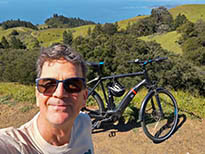
It's been years, maybe even a decade, since we last hiked to the West Point Inn, so we decided to make a loop that would take us up there and beyond, starting on the Matt Davis Trail at the Bootjack parking area. I wouldn't mind spending $8 to park there if I had a heavy cooler and was going to use the picnic area, but since we just needed a trailhead we parked on the other side of the street.


The picnic area is kind of interesting on its own, although no one was using it when we set out at 8:45 in the morning. I don't think anyone was using it when we got back at around 11:15 either, finding very few cars in the lot and still no one parked behind me across the street. I know that parking lot fills up eventually, and that people do picnic there, but I guess it was still too early. You might think hanging out on the south-facing side of the mountain on a summer day would be crazy hot, but it was supremely pleasant. The fog was close, just below Bootjack, but everything above that was sunny and warm. 


It was 59 degrees when we set out, and the warmest it got during our hike was a mellow 72. I guess we were paying too much attention to the picnic area because we missed our trail, heading to the left of this sign and up the Bootjack Trail. We soon reached the ranger station and ran into a ranger who set us in the right direction.


The Matt Davis was probably the "bridgy-est" trail I've hiked on Mt. Tam. So many bridges. I guess it's appropriate since Matt Davis (d. 1938) was known as "the dean of trail workers" back in the early days of the Tamalpais Conservation Club.


The obligatory manzanita tunnel.


The trail follows the contours of the mountain in a very shallow descent and has lots of great views, even when the long views are obscured by heavy fog.


It's also nicely varied. One minute you're in the woods, and the next you're out in the chamise chaparral.


The trail forks at this bridge, with the Matt Davis continuing on the right toward Mountain Home Inn. But we turned left onto what here becomes the Nora Trail, which takes you up through the woods to...


...the West Point Inn.


There were a few guests, but it was fairly quiet here in the lounge.


Besides finding restrooms, shade, and comfy chairs, Pam even got to tickle the ivories a little. And yes, the piano was even in tune.


A squadron of hummingbirds availed themselves of the Inn's hospitality as well.


On the other side of the Inn, we continued our hike up the Rock Springs Trail. Up at the top of the mountain, you can just make out the white radome (the "golf ball" protecting the radar unit long-since abandoned by the Air Force, but still in use by the FAA). Missiles fired from the nearby Nike Missile Site were guided by electronics placed up there as well.


Again, there were lots of great views and open areas like this serpentine outcrop.


I've hiked out on the north-side trails many times where I hardly ran into anyone. That is not a likely scenario here on the south side. There were large groups and small groups, trail-runners and dog-walkers. And for good reason, since the whole route is fairly easy and a pleasure to behold.


The Rock Springs Trail ended here at the Mountain Theater. The oak tree on the far right of the frame is where Pam and I staked out during the recent Tam Jam rock concert. Shade is scarce, and we were glad to have it on that hot and sunny day.


On the other side of the Mountain Theater, the trail drops down, with the Bootjack Trail going left and the Easy Grade Trail going right. Like the folks in the picture, we also took the Easy Grade.


View of East Peak from the Easy Grade Trail.


And before we knew it, we were picking up the Matt Davis Trail again where the Easy Grade runs into the (paved) Old Stage Road. It was just another five-minute hike from here back to Bootjack and the Jeep.

We're thinking about the next trip being a Lower Bootjack Loop, starting at nearby Pantoll but heading down to Muir Woods.

* * *

Wednesday, July 31, 2013

July Favorites

* * *

Mt. Tamalpais has been a magnet for huge numbers of people for well over a century. Explorers, hunters, artists, writers, botanists, tourists, hikers and runners have felt its pull. Even loggers and ranchers, who came to the Mountain to earn their livelihood, probably enjoyed it for itself. The image of the Mountain which so many revere is in large part the product of those who have loved it.

--Lincoln Fairley in the Preface to Mount Tamalpais, A History


Young Buck


Field Impressions


Pacific Forktail


Pacific Treefrog at High Marsh


Cardinal Meadowhawks


Mr. Slithers


Sunrise Trail


Poison Oak


Madia elegans


Handsome Hopper


Young Sleeper


* * *

Sunday, July 28, 2013

Fog's Edge

* * *


You had to go all the way up to Rock Spring 
to get above the fog this morning.


I didn't go up with a plan to shoot anything in particular, so I strolled along the edge of the fog, thinking I might see something interesting.


Given the interesting light, the quest was on to find interesting subjects to photograph. I liked the juxtaposition of the two stones here, as well as the tiny red buckwheat and wind-combed waves of dead grass. Although I didn't photograph them, I saw numerous long lines of foraging ants carrying grass seeds into their subterranean nests.


Fogbows work along the same line as rainbows, forming at the antisolar point (i.e., with the sun at your back), making it easy enough to get this little Doug fir tree to line up in the middle of the bow.


It's one dry watershed this high up the mountain. There was a fair amount of fog-drip dripping, but nowhere near enough to make the stream cobbles damp in Cataract Creek.


My stroll along the fog's edge took me along this ridge 
of serpentine near Rock Spring.


Serpentine is California's state rock. There was a legislative attempt (SF Gate article) to repeal Section 425.2 of the Government Code which would have removed its designation, but the bill, though still alive, has languished in committee since August 2010.


I spent so much time with the fog that by the time I chanced to see a group of wild turkeys and, a little later, a buck deer foraging on fresh fir leaves, the good light was gone. I meandered into the forest to follow a trail I'd never used before, and it led me to one of the most excellent sit-spots I've ever encountered up there. It was comfortable and secluded despite being close to a main trail and commanded a satisfying view into the surrounding forest. I lay down my camera backpack and tripod and sat with my five physical senses alert, and one or two spiritual senses too, just taking in the natural surroundings. It was almost hypnotic. Eventually a big black ant dug its pincers into my leg and snapped me out of it. Time to move on.

* * *

Saturday, July 27, 2013

Sitting Bull Plaque

* * *


We left the heavy fog in San Francisco with the hope of reaching sunshine, but our short four-mile round-trip hike to the Sitting Bull Plaque began on a windy and chilly morning.


Starting once again from the Mountain Home Inn, we trekked along the Gravity Car Grade into Marin Municipal Water District lands, then continued along the Hoo Koo E Koo fire road past last week's junction at the Vic Haun Trail.


The Temelpa Trail isn't signed, but it's easy to spot where it intersects the road.


The Temelpa is a steep trail, worn down to bare rock by winter rains.


The Sitting Bull Plaque is set in this big boulder and is a very simple design (inset). It reads (approximately):

"Behold, my friends, the spring has come; the earth has gladly received the embraces of the sun, and we shall soon see the results of their love! Every seed is awakened, and all animal life. It is through this mysterious power that we too have our being, and we therefore yield to our neighbors, even to our animal neighbors, the same right as ourselves to inhabit this vast land.

"Yet hear me, friends! we have now to deal with another people, small and feeble when our forefathers first met with them, but now great and overbearing. Strangely enough, they have a mind to till the soil, and the love of possessions is a disease in them. These people have made many rules that the rich may break, but the poor may not! They have a religion in which the poor worship, but the rich will not! They even take tithes of the poor and weak to support the rich and those who rule. They claim this mother of ours, the Earth, for their own use, and fence their neighbors away from her, and deface her with their buildings and their refuse.

"This nation is like a spring freshet; it overruns its banks and destroys all who are in its path."

I say "approximately" because instead of transcribing the sign, I cut-and-pasted the text from a web page about Sitting Bull (here).

Apparently the plaque was first put up in 1993 (there's no mention of it in Lincoln Fairley's 1987 Mount Tamalpais, A History, nor is it shown on the 1989 Olmsted & Bros. map), then later replaced by a more scratch- and weather-resistant one (link). An even more elaborate shrine was installed, only to be taken down by the same breed of water district officials who periodically dismantle the Music Camp (an out-of-the-way spot, frequented by gnomes, on a connector trail between Laurel Dell Road and the High Marsh Trail).


We got our only taste of sunshine at the Sitting Bull Plaque. The Temelpa Trail continues up to East Peak, but we continued just a few steps farther to pick up the top of the Vic Haun Trail and head back down.

* * *

Saturday, July 20, 2013

Vic Haun Trail

* * *


It was nice to leave the big camera at home and just snap some shots with the Coolpix P7100. Last week's jaunt down the Zig Zag Trail took us to the bottom of Cascade Creek. This time we started at the same place but took the Vic Haun Trail (Haun was a founder of the California Alpine Club) to the creek's headwaters.


It was 57 degrees in the fog, which made for a nice cool hike. Redwood trees in the background pull enough precipitation out of the fog to support themselves as well as a host of ferns, and even a few russulas.


We hiked out along the Gravity Car Grade, sharing the route with bicyclists, trail-runners, dog-walkers and other hikers.


Our trail forked to the left at about the one-mile mark. Incidentally, I'm using the Mt. Tam Trail Map from Tom Harrison Maps, which shows trail distances.


I haven't done much hiking on this part of the mountain, so having a map was invaluable. There are also plenty of signs to help you get your bearings. We hiked past our trail turn-off to have a look at Cascade Creek where it crossed the Hoo-Koo-E-Koo, then doubled back to pick up the Vic Haun.


Elk clover, aka spikenard, gone to fruit along Cascade Creek.


We finally left the fire road at the Vic Haun Trail. This section is marked as the Old Plane Trail on the Harrison map, but a trail marker just calls it Vic Haun. Mountain biking isn't allowed on these little trails, but we still encountered an idiot riding down who almost plowed into Pam.


The Vic Haun Trail took us above the fog (with East Peak in the background). We went from the high 50s to 80 degrees in just a few short steps. The chaparral was composed of manzanita, chinquapin, coffeeberry, oak, toyon and other hardy plants of Mt. Tam's southern flank.


Where the Vic Haun crossed the upper reaches of Cascade Creek, the creekbed was bone dry. Pam had been hoping to find a spring at the headwaters of the creek since that had been the destination of the previous week's wild edibles walk mentioned in my last post. 

We hiked down an unmaintained trail next to the creek, knowing it would eventually run into the Hoo-Koo-E-Koo fire road, and we were in sight of that road before we finally found water running well enough to collect in a bottle. Pam felt this water must be special since it was the destination of a commercial hike led by vegans, but to me it was run-of-the-mill creekwater. 

Finding cardboard coffee cups left by idiots in the vicinity reminded me of the saying, "Never drink water downstream of a white man." I drank some, nevertheless. As of this writing, Pam, though she collected a bottle's worth, still hasn't had a drop. She still remembers what it felt like to pick up a giardia cyst in the Ishi Wilderness 12 years ago or so. I didn't get sick on that trip, and I'm hoping my luck holds out....


The red "berries" are chinquapin galls, made by cynipid wasps (Dryocosmus castanopsidis).


This chipmunk was gnawing on a real red berry -- from a manzanita.


We took a different route back, following a fire road above the part of the Hoo-Koo-E-Koo that's a true trail (not a fire road). It was 0.7 miles to the Hogback, then another 0.6 or so down the Hogback and back into the fog.


We both enjoyed being on a different part of the mountain. It was nice to see a different plant community and to often be hiking in the open. We could easily see Mt. Diablo in the distance, but all of the earth between there and Mt. Tam was covered by fog. Even Sutro Tower was obscured. Looking at the map, there is no end of loop hikes to choose from. We're looking forward to further explorations in the area.

* * *