Tuesday, February 28, 2023

Rainy Days


Storm Squall Floating Over San Francisco

The wind chill was almost certainly dipping into the 30s yesterday (~45 degrees w/ 25 mph wind) as I waited for the squall above to blow into rainbow position. It felt downright wintry in the stiff wind that was blowing most people off the top of Grandview Park after just a few minutes of taking in the view. 

I had seen the squall on internet radar and drove over to the park in the hope of catching a big bow over the city, but it was not to be. A little bitty fragment showed up briefly, but even that scrap of color was gone before it drifted into a more interesting position over the city.

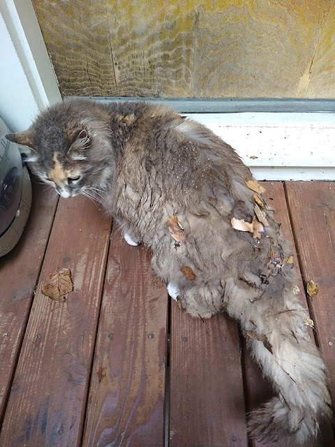
I had hoped to try again today, but Coco, the semi-feral neighborhood cat that we've been feeding (and sheltering on cold or rainy nights), seems to have come down with something, and I'm still waiting to go pick her up from the vet. I wasn't prepared for the sticker shock of going to the vet since I haven't been to see one in probably thirty years. Wow. Hopefully they'll get her back to her frisky self soon.


Color Streak


The Pegasus Voyager oil tanker sails into headwinds in the Golden Gate, with storm clouds blowing in over the Marin Headlands and Mt. Tamalpais.


Phone Snap from Grandview Park


Coco the Cat, after sleeping in the rain under a neighbor's oak tree a couple of days ago.

* * *
Monday, February 27, 2023

Bird Flu for Bandies


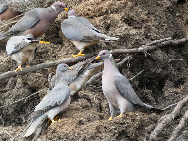
Band-Tailed Pigeon

I just read that band-tailed pigeons are having an outbreak of Avian trichomonosis (which is caused by a protozoan rather than a virus like bird flu, but I took alliterative license in the title of this post). So far this season an estimated 200-300 of these sleek and colorful California native pigeons (Patagioenas fasciata monolis) have succumbed to the virus, which thankfully is a far cry from the estimated 18,000+ that died during the record-breaking warm years of 2014 and 2015. Meanwhile, an estimated 5,600 birds were taken by hunters in the Pacific Coast region in a recent season, which lasts only eighteen days (it's split into two nine-day seasons by region).

Infection with avian trichomonosis isn't always fatal to the bandies, but it can cause lesions in the upper digestive tract that block the passage of food and even air, and eventually cause death. The birds encounter the parasite from contaminated water or food, and adults can infect their chicks when feeding them. The parasite, Trichomonas gallinae, can infect domestic fowl and other wild bird species as well, including raptors that eat infected birds.

Bird feeders and baths are believed to be sites of transmission of the parasite and should be cleaned regularly to help prevent infection.


Bandies Feeding on Soil (or something in the soil) at Agate Beach in Bolinas


Band-Tailed Pigeon Showing Its Tail Feathers


Bandies at a Watering Hole


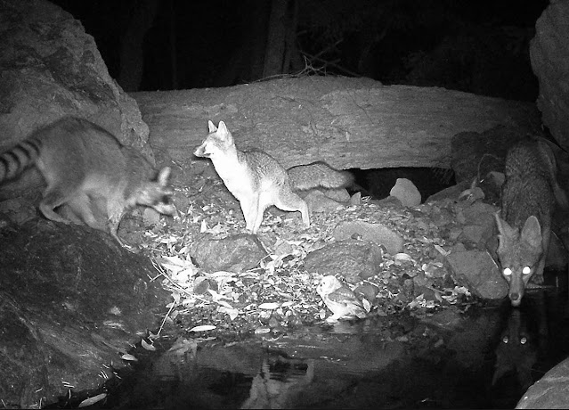
Four Other Water Hole Visitors (Montage)

* * *

Friday, February 24, 2023

Grandview Park


Rainbow Over the Richmond District

I was browsing the internet this morning with my oatmeal and coffee when the sun started breaking out. I wondered if I might have time for a walk down to the beach, so I checked the weather radar and then the Ocean Beach web cam. 

The radar showed that rain was almost certain to get me, but I was surprised to see on the Ocean Beach cam that snow had fallen lower than I'd expected on Mt. Tamalpais. I bolted from the computer, grabbed my camera gear, and drove over to Grandview Park to try to photograph the snowy mountain. 

Unfortunately, even in the short time it took me to climb the steps to the vista point, a phalanx of clouds moved into to obscure the snowy ridge. For just a couple of seconds near the bottom of the stairs I had been able to see the whole mountain from the ocean to East Peak adorned with a frosting of snow, but by the time I reached the top and set up the camera, huffing and puffing, the mountain heights were almost completely obscured.

I hung out for quite a while, hopeful that the mountain would reveal itself again, and shot some time lapse footage instead of just standing in the cold. No luck on the clearing. Meanwhile a dense rank of storm clouds was blowing closer and closer, and with the first few drops I packed up and took refuge in my car. 

The storm passed over, by and by, and a rainbow began to form over the Marin Headlands. I grabbed my gear and started hiking back up the stairs when I stopped to photograph a ship heading out to sea, disappointed that I couldn't have caught it closer to the foot of the rainbow. The ship turned out to be a vehicle carrier called Cetus Leader that had just left its San Francisco anchorage bound for Nagoya, Japan.

It was interesting to see the rainbow so low on the horizon. A little later I thought I might see another bow as a squall moved perfectly into position, but by then the sun was so high that no rainbow could be seen (42 degrees above the anti-solar point, where the rainbow would be, was well in front of the rain squall).


View from the fire look-out on Mt. Tam's East Peak this morning


Clouds Preparing to Obscure the Last Bit of Snow


Crop of Previous Image


Rain Heading for the City


City View from Grandview


Japanese Vehicle Carrier Cetus Leader with Rainbow


Rainbow Fragments
(click images to view larger)


Time Lapse of Clouds Over Mt. Tamalpais

* * *

10K Ride


Esplanade Sea Wall

Just out and about on Thursday when the odometer rolled over from 9999 to 10000. 


Mileage Milestone


Beach Horizon


Cedar Waxwing in a Juniper

* * *

Thursday, February 23, 2023

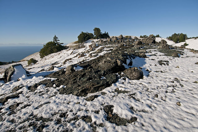
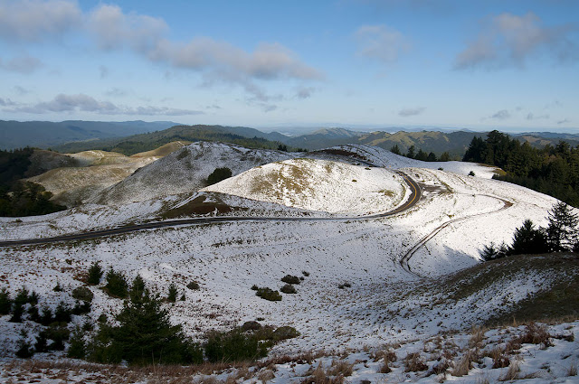
Snow on Mt. Tamalpais


Snow People on Mt. Tamalpais, Feb. 20, 2011

I forgot my snow shots weren't already on the blog (except this one), so I thought I'd post them in light of the possibility of getting some new snow this week. I doubt anything like this 2011 snowfall is in the cards, but you never know.


Serpentine Power Point


Snowboarding on Mt. Tam


Coyote Tracks in the Snow


Bolinas Ridge


Oak Rock


West Ridgecrest Road and Laurel Dell Road


Black Chanterelles


Cataract Creek Trail


* * *

Wednesday, February 22, 2023

Sand Check


The Great Highway had an unscheduled automobile closure today, courtesy of Mother Nature.


Two phone snaps from the edge of the dune.


I avoided this bike/pedestrian path yesterday because the wind was even stronger, making this stretch look like it was being sand-blasted. Looking back the other way, a car is taking a detour through the Beach Chalet's parking lot because there is deep sand accumulated on the Great Highway, and not just here but in many spots along the front of Golden Gate Park.


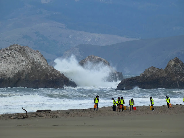
I was going to head back up through the park when I noticed huge waves crashing into Seal Rocks: guano cleaning, courtesy of Pacific Power Wash. I was also amazed to see a group of sturdy young people doing a beach clean-up. They should have had some news media down there. I was not surprised when their supervisors called them in shortly after I packed my camera to get the heck out of that cold wind.


Luckily, this tree (one of several newly fallen trees since yesterday in Golden Gate Park) broke in two in just the right place. :)


* * *

Wind Check


Cliff House Wind Check: 39.2 MPH

I went down to the beach yesterday, and I'm still finding sand in my ears. 

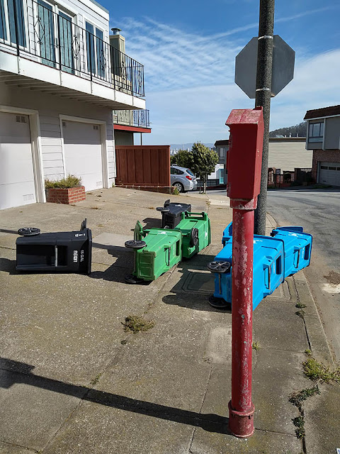
Early morning started off innocently enough, with just the usual breeze, but by mid-morning the forecast winds began to arrive. Toppled garbage cans lined my walking route, and I heard the wind slam a door shut on 16th Avenue, followed by the sound of shattering glass.

Once I got home from my morning walk I wasn't so sure I even wanted to go for my usual bike ride. But I did want to experience the powerful winds. And when I remembered the hand-held anemometer I'd stowed away in a knick-knack drawer I knew I had to take it for a ride to the beach. When I got there, I struggled against the headwind despite being on an ebike. I sure was glad I'd ridden up to Mt. Tam on Monday instead of Tuesday.


Windy City


Wind Tracks on the Ocean


Gale at the Beach
(music by The Mermen)

* * *

Tuesday, February 21, 2023

Cam Check


High Tide on Coyote Creek

I probably wouldn't have stopped on my way to Mt. Tam yesterday if I hadn't spotted the American Avocets foraging along the shore of Richardson Bay near Coyote Creek. The Black-Necked Stilts are still around, but seeing avocets in this area was a new sighting for me. They were unafraid of my presence and fed just a few feet away, scything their bills back and forth but not snagging anything I could see. Well-camouflaged Willets foraged for critters in the saltgrass, moving about on foot while whistling Wigeons nibbled on plants from the water.

The holiday auto traffic was fairly heavy on Panoramic Highway, but I had decided not to wait to go up today because of the forecast of heavy winds. Yesterday was a gorgeous day for a bike ride. On reaching Mt. Tam my odometer showed I was about 50 miles away from reaching 10,000 miles. Next month I'll have had the ebike four years. Estimates for battery life are all over the place, but mine still seem to be fine.

On the hike up to the cams I spotted the biggest jackrabbit I've ever seen. It was a sprightly hare despite its size and galloped off in the direction of my cams, then finally zoomed up the hill and out of sight after allowing me a quick photo. 

When I reached the cams I was excited to find a crime scene -- Band-Tailed Pigeon feathers in a pile -- next to the little creek. The cameras appear to have caught an attack from maybe a Cooper's Hawk, but it happened too fast, and the image is too weak, to be sure. The other interesting capture was an animal I can't identify. If we had Pikas, I might have guessed that's what it was. If you have any ideas, drop me an email (jwallphoto at either gmail or yahoo).


American Avocets & Black-Necked Stilt


American Avocets on Richardson Bay


Feeding Avocet Showing Curved Beak


Willet in the Pickleweed and Saltgrass


Male Wigeons on Coyote Creek


Jumbo Jackrabbit


Crime Scene


Band-Tailed Pigeons Drinking from Creek @ 8:11:07 a.m.


Fleeing Pigeons & Crime Scene @ 8:11:45 a..m.


100% View of Blue-Circled Bird
(Is it a raptor or just another pigeon?)


Another Angle: The Attack Happens Fast


Homage to a Bandie


Unknown Creature Zooms Up the Creek


100% View of Unknown Creature


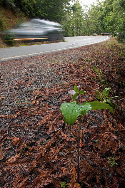
Panoramic Highway, Feb. 20, 2023


Panoramic Highway, Feb. 20, 2012


High Tide Along the Mill Valley-Sausalito Pathway

* * *